morePlatz
architecture / urbanism / art / office / publications / contact deutsch
 |
Harbour areas usually are close to the city centre. They represent an almost tabula rasa situation. New concepts and design parameters can be implemented at a large scale, which is mostly impossible in given city – context. This includes considerations of sustainability, new life-styles etc e.g. Hamburg, Genova, Kopenhagen, Amsterdam Harbour areas have a strong characteristic identity and atmosphere; the traces of labour and usage; the proximity to the water; the large spaces of bassins and long stretched quays. First, a valid strategy for conversion of these areas into new neighborhoods and public space must aim for preserving its unique character and make it accessible and usable. Secondly ‘thinking blue’ means to further improve the waterquality in the bassins of Nørdhavnen, since it is part of that public space and should as well be suited for a lot of activities. |
|
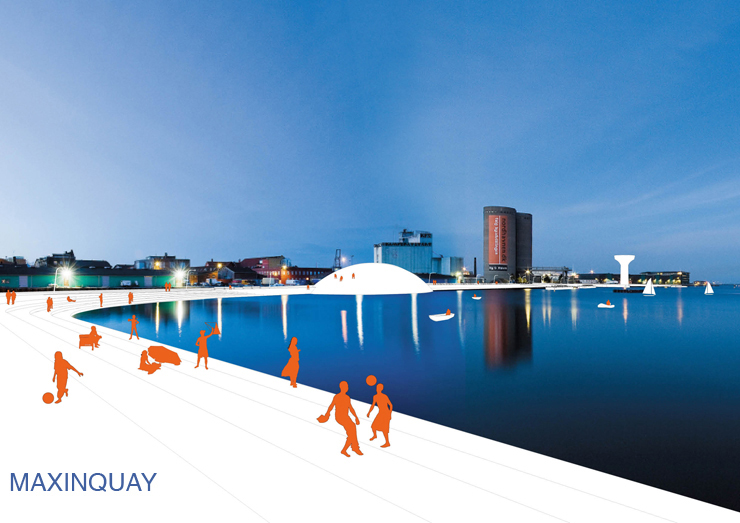
| PUBLIC SPACE
In Nørdhavnen there will be a lot of public space along the water: calculating an average width of 20m it totals more than 25ha of quay space and more than 12km of quay length: it roughly doubles the accessible quay-length of Copenhagen centre. |
 |
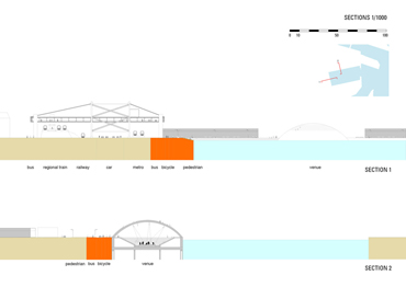 |
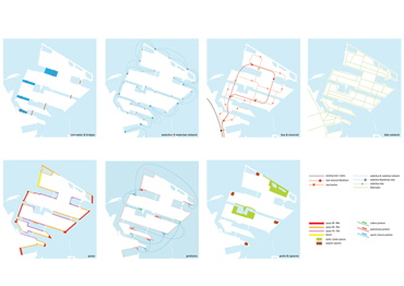
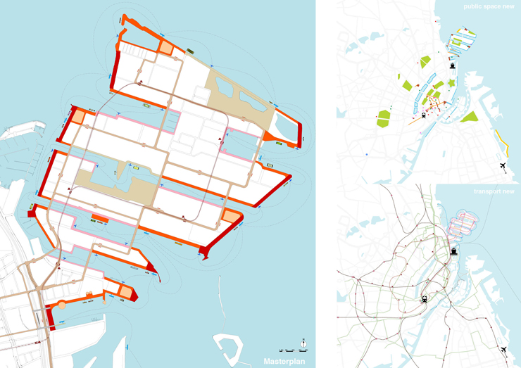
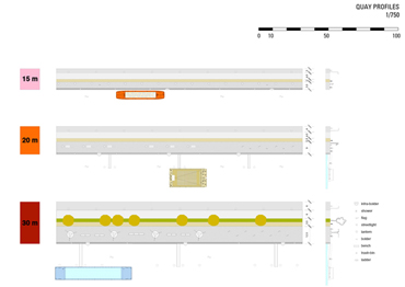
STRATEGY - add connections of the site with the city centre - bridges over the infrastructure barriers - bike connection - public transport - monorail train; buslines; waterbus; watertaxi network - add new water to avoid dead end water bassins: improve water-quality and allow for shortcuts and a network of watertransport - add useful and functional quay profiles according to orientation. 3 kinds of profiles are proposed all of which accomodate pedestrian and bike lanes, stops for watertaxi and waterbus, bike stalls, public showers and benches - A. 10 - 15m: serves the circulation and access with the main functions (mostly North oriented) - B. 20 - 25m: serves the circulation and access plus has an extra width that allows for additional programme like picnic, playground, cafes on the quay, steps down to the water, plants; etc... (mostly South oriented) - C. 30 - 40m: these are part of the circulation network, but offer extra qualities for viewing points, resting areas, mini parks (mostly at the heads of the quays) |
|
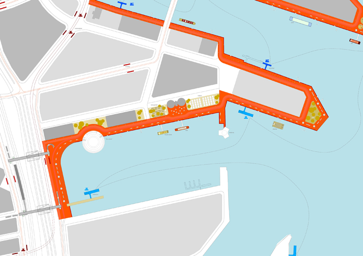
- add squares, parks and venues: like in the existing urban fabric there is a number of special places to create addresses and destinations in the new area. They are combined with public program. - add public functions like restaurants, bars, hotels, theatre, museum, pools, beach, market, cinema - add an extra layer of floating public program attached to the quays that can vary in position over time or according to season – the usage of the quays can be programmed or curated. A catalogue of specially furnished and equipped pontoons or hopper-barges allows to install public functions and to help activating the quays without imposing a fixed design. These are an important element in order to guarantee the usage of the quays throughout the year. With the winter season being quite long in DK, these barges can be maintained and converted to covered spaces in its own ‘barger-dock’. Thus public functions can be provided along the quays all year long. spots will be designed especially as places for public venues. |
 |